


The data sources that can provide information of vector type are the vector files (SHP, DWG...), the vector databases and the WFS y ArcIMS Feature services.
The 3D views allow representing vector data in two ways: rasterised, as images glued over the terrain surface, and as three dimensional objects. The 3D extension offers the user the two options for all the mentioned data sources, although the results obtained with the ArcIMS Feature Service is not adequate for representation as 3D objects given how it draws this type of layer.
When the user adds a vector layer to the view the following dialog will show:
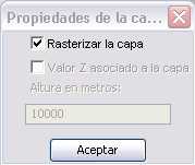
Vector layer options.
When the rasterisation option is deactivated to represent the vector data as objects in 3D, the elevation values (Z component) given by the geometry of the data can be used. If this option is selected and the geometry does not contain Z values, it will default to zero. This can complicate the visualisation in 3D since the terrain surface will mask the data.
Because of that, if the vector data does not contain elevation it would be better if the user assigns an elevation value in meters using the entry field in the lower part of the dialog.
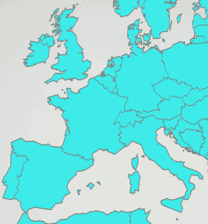
Example: Capture of layer with rasterised polygons in Europe.
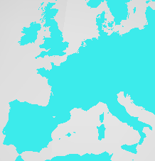
Example: Capture of layer with un-rasterised polygons in Europe.


